Playa del Carmen (
Xaman Ha' or
Pláaya in
Modern Maya) is a
balneario resort city just south of
Cancún on the coast of the
Caribbean Sea, in the northeast of the
Mexican state of
Quintana Roo. The city is the seat of the
Solidaridad municipality. In the 2005 census, the city had a population of about 100,383 people and it is rapidly growing in population. It is the third largest city in Quintana Roo, after
Cancún and
Chetumal.
 |
| Main Beach Panorama (from ferry station) |
 |
| Looking south (from Ferry Station) |
|
History
Playa del Carmen is named for
Our Lady of Mount Carmel, who is the patron saint of Cancún. The first recorded visitors to the beaches of what is now Playa del Carmen came during the Early Classic Period (a.d. 300-600) of the Mayan civilization. Then called Xaman-Ha, or "waters of the north," Playa del Carmen was a rest stop of sorts for travelers making their way from the great cities of the Mayan world to the island of Cozumel.
 |
| Ferry to Cozumel |
The coast and lowlands of the peninsula were still heavily populated with the descendents of the fallen civilization when the Spaniards arrived.
Tulum, less than an hour south of Playa, was the last Mayan outpost and there are plenty of small ruins in Playa del Carmen. The Spanish focused their attention around the area of Mérida, where conditions were better for growing henequén (sisal), a fibre used to make rope. During the 17th and 18th centuries, the Caribbean coast was considered a savage place with not much to offer for potential settlers.
Tourism
Originally a small fishing town,
tourism to Playa del Carmen began with the passenger ferry service to
Cozumel, an island across the Cozumel Channel and world famous
scuba diving destination. While passing through, many people realized that it was a nice place to relax away from the crowds of
Cancún but with the same quality beaches and turquoise waters. While its salt water scuba diving cannot compete with
Cozumel, for the adventurous, Playa del Carmen's fresh water
cenote diving more than makes up for it.
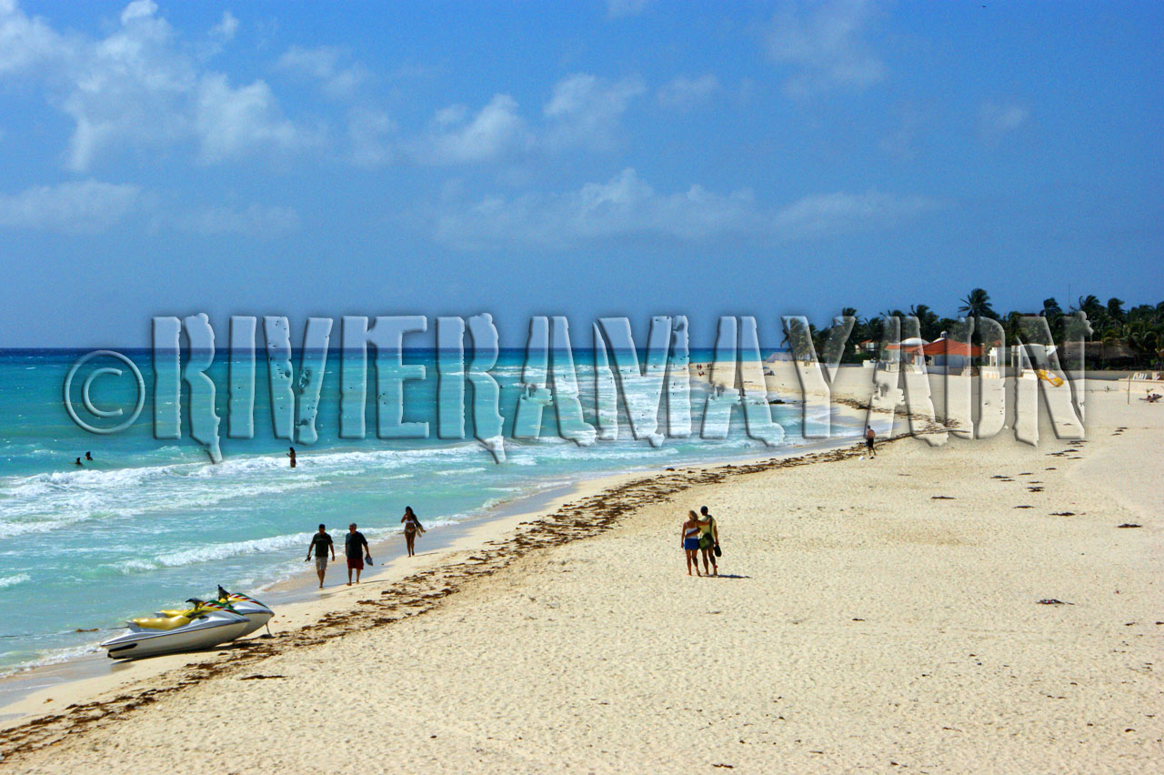
 |
| Main beach |
Today Playa del Carmen, or just "Playa" as it is colloquially referred to, is the center of the
Riviera Maya concept, which runs from south of
Cancún to
Tulum and the
Sian Ka'an biosphere reserve. Playa is a stop for several cruise ships which dock at the nearby
Calica quarry docks, about six miles south of the city. The
Xcaret Eco Park, a Mexican-themed "eco-archaeological park", is a popular tourist destination located just south of the town in
Xcaret (pronounced "shkar-et"). Tourist activity in Playa del Carmen centers on Quinta Avenida, or Fifth Avenue, stretching from Calle 1 norte until Calle 40, a pedestrian walkway located just one or two blocks inland from the beach. Fifth Avenue is lined with hundreds of shops, bars and restaurants. There are many small boutique hotels on Fifth Avenue as well as just off Fifth Avenue and on the beach, such as Luna Blue Hotel & Bar, Fusion Beach Hotel Bar & Grill, Deseo, Basico, Casa Ticul, Barrio Latino, La Tortuga and many others.
 |
| Main beach |
The Playa del Carmen local community and government have attempted to retain Playa del Carmen's reputation and charm as a small fishing village and artists' colony, without it becoming as large and metropolitan as Cancún. To this end, the city passed an ordinance limiting buildings to four stories. A few five story buildings were built despite the ordinance, however. Playa del Carmen is currently expanding north beyond the Colosio section and on the other side of highway 307, the Ejido.
Playacar is a residential and tourist development in Playa del Carmen, just south of the main urban area. In this development most of the all-inclusive hotels, the aviary, and the golf course are located. There are two phases, phase 1 is mostly residential with a few hotels and some stores. Phase 2 contains the largest all inclusive resorts along with the golf course and a significant number of residential properties. Playacar was developed starting in 1979 by Mr. Fernando Barbachano's company: Compania Impulsora Turistica de Playa del Carmen, S.A., The development was later sold to Aircoa, an American Corporation, which later sold the development to SIDEK of the Martinez Huitron Family and more recently sold to Mr. Ernesto Echeverria.
There is a significant European influence in Playa, with a number of local business proprietors drawn from the American and European
expatriate community. In addition a significant amount of Playa's tourists include thousands of backpackers from around the world, who pass through Playa while touring Mexico and the surrounding region.
In October 2005
Hurricane Wilma passed directly over Playa del Carmen, remaining in the vicinity for two days and causing significant damage and a temporary drop in tourist arrivals. Fortunately most of the damage was relatively superficial and repaired within a few weeks of the storm. Hurricane Wilma arrived from the Caribbean sea, passing over
Cozumel before making landfall in Playa del Carmen. It then moved north along the Mexican coast, hitting
Cancún especially hard. In February 2010 an important and massive program of local and central authority gave back the Downtown area and Playacar a long, beautiful white sandy beach.
 |
| Boat at main beach |
Sports
The city is home to Inter Playa del Carmen, a
football (soccer) club founded in 1999, currently competing in the south group of the
Segunda División Profesional, third tier of Mexican football league system. The city is also home to the Carmen Hockey Club, captained by Ty Christie, Calgary, Alberta.
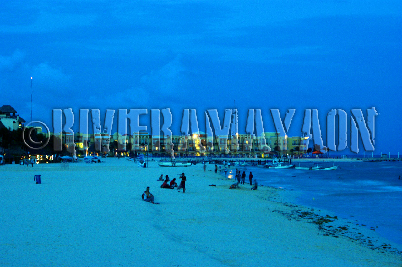
 |
| Beautiful evenings at Playa del Carmen |
 |
| Beautiful evenings at Playa del Carmen |
---


